
An Bhinn Bhui [Benwee Head]
Good walks are even better shared.
Overview
An Bhinn Bhui [Benwee Head]
An Bhinn Bhui, mystically perched above the wild Atlantic Ocean, is not just a Marilyn, but a crowning jewel in County Mayo’s diverse landscape. At 228 meters, it challenges the notion of the ‘typical mountain’, offering captivating views that make it a worthy outing for both casual walkers and seasoned hikers alike.
Geology
The underlying geology of An Bhinn Bhui is a fascinating blend of limestone and sandstone. This geological history provides insight into millions of years of natural processes, creating not just a remarkable landscape, but also a habitat for various wildlife.
Routes
The primary route, Benwee Head Loop Trail, is a scenic 6.5 km hike that embraces the mountain’s natural beauty. Most hikers complete the loop in about 2.5 hours, making it perfect for a half-day adventure. This moderate trail winds its way through lush greenery with the occasional rocky outcrop for a bit of challenge, so pack your sense of wonder and a sturdy pair of boots!
Summit Features
Reaching the summit rewards hikers with a modest stone cairn, symbolizing the culmination of their journey. It's a fantastic spot for a breather and perhaps a cheeky snack while soaking in those stunning views of the Atlantic across to the Mullet Peninsula.
Terrain Type
Expect a range of grassy stretches mixed with rocky patches, adding a layer of variety to the walk. Note that the terrain is quite forgiving, but keep your eye out for the occasional slippery section!
Views
At the top, the views are simply spectacular. You can see the rugged coastline, shimmering in the sunlight, and a myriad of shimmering blues where land meets sea.
- Highlights: Look out for the iconic cliffs dotted along the shore, and on a clear day, you might even spot distant islands.
- Best Seasons: Spring is blooming with wildflowers and clearer visibility, while autumn offers crisp air and striking colours.
Hazards
As lovely as it is, every coin has two sides. Be cautious of steep drops near cliff edges, and pack a light jacket; coastal weather can be as fickle as a cat on a hot tin roof!
Nearby Summits
For those looking to extend their hike or explore further, Mullaghmore is a nearby peak worth considering for its impressive elevation and panoramic vistas.
Access
Nearest Parking
A small parking area can be found off the R313 road close to the loop trail start. However, do arrive early, especially in summer, as spaces can disappear faster than snacks at a picnic!
Public Transport
Public transport to this scenic location can be a bit of a challenge. The nearest bus runs from Ballina to Easkey, so be ready for a short taxi ride to get to the trailhead.
Nearest Town
Ballina is your best bet for nearby amenities, being just 10 km away. Here you can stock up on essentials or grab a well-deserved post-hike pint!
Facilities
Facilities are limited on the mountain itself. Make sure to fill your flask and pack some snacks before you set off. Ballina, however, boasts numerous cafes, restaurants, and convenience stores.
History
Name Meaning
The mountain's name, An Bhinn Bhui, means 'The Yellow Peak,' likely hinting at the views the peak offers during sunrise or the yellow wildflowers that dot the landscape.
Significance
Steeped in myth and legend, this area holds historical significance, echoing stories of ancient Gaelic tribes that once roamed these lands in pursuit of adventure…and the odd dragon or two!
Make sure to channel your inner explorer when venturing onto An Bhinn Bhui; after all, every summit has a story waiting to be discovered!
Explore routes near An Bhinn Bhui [Benwee Head]
Public walks starting within 80 km of this hill. Nearby does not mean a route reaches the summit; check its map and access before setting out.
No public routes are currently listed within 80 km of An Bhinn Bhui [Benwee Head] on Walkmates. This does not mean there are no paths here. Explore the map and check local access information before planning a walk.
Route planning notes
These notes describe possible approaches, not verified navigable routes or permission to cross land. Check current paths, local access rules and conditions before setting out.
Benwee Head Loop Trail
A scenic loop that encircles the headland with views of the Atlantic Ocean and the surrounding countryside.
Make a day of it, together
Find someone to share the walk with, or organise a day out along a route you like.
Hill facts and local notes
Classifications
Elevation
255m
837 ft
Prominence
221m
Coordinates
54.3337, -9.8225
F815443
OS Map
22
At the Summit
The summit features a simple stone cairn marking the highest point along with spectacular views over the Atlantic and neighbouring cliffs.
Terrain & Geology
The mountain is predominantly composed of limestone and sandstone, providing a unique insight into the geological history of the region, which has shaped its topography over millions of years.
Views & Scenery
From the summit, hikers can enjoy panoramic views of Dublin Bay, the Mullet Peninsula, and the rugged coastline dotted with cliffs and sea stacks.
History & Heritage
Name Origin
An Bhinn Bhui translates to 'The Yellow Peak' in Irish, likely referencing the flora or the way the light hits the summit.
Historical Significance
The area has historical significance in Irish folklore and was often frequented by Gaelic tribes.
Getting There & Facilities
Check current local access restrictions, parking rules and transport timetables before travelling. These notes do not confirm public access to the summit.
Parking
There is a small parking area along the R313 road near the starting point of the loop trail.
Public Transport
The closest bus service operates from Ballina to Easkey, but further travel may require a taxi to reach the trailhead.
Nearby Facilities
There are no facilities on the mountain, but Ballina has several cafes, restaurants, and public toilets for hikers' convenience.
Safety Information
Known Hazards
- Beware of steep drops near cliff edges, and be prepared for sudden weather changes typical of coastal areas.
General Safety Tips
- Check weather conditions before setting out
- Carry appropriate clothing and equipment
- Let someone know your planned route
- Take a map, compass, and GPS device
- Carry emergency supplies: food, water, first aid kit, torch
Hills
Some common questions about the hills answered
Are there group walks up An Bhinn Bhui [Benwee Head]?
Many walkers use Walkmates to join or organise walks with others. You can check for group walks around An Bhinn Bhui [Benwee Head] through the maps
Are there other walkers around An Bhinn Bhui [Benwee Head]?
Activity varies by location and time, but Walkmates lets you see whether others have shared walks or shown interest in this area. Find other people through the walking friends search walking friends for An Bhinn Bhui [Benwee Head] search or of course create your own walk for An Bhinn Bhui [Benwee Head]
Can I organise a walk to An Bhinn Bhui [Benwee Head]?
Yes. If there aren’t any walks listed already, you can create a walk and make it available for others to join.
If you're signed up to Walkmates, you can create a walk to An Bhinn Bhui [Benwee Head].
How do I find a walk up this hill?
There are often multiple ways to walk this hill, depending on experience and route preference. Walkmates helps you explore walks and routes that others have shared.
Can I suggest a new route up An Bhinn Bhui [Benwee Head]?
Yes. You can suggest or create routes to share with others. Walkmates focuses on the social side of walking, so routes are used to help people organise walks and explore areas together, rather than as detailed navigation tools or route libraries.
Other uses really appreciate knowledgeable walkers sharing their routes. Share your favourite route to An Bhinn Bhui [Benwee Head] here
The is an error or something incorrect about this hill. How do I let you know?
We always strive to keep the information on Walkmates as accurate as possible. If you find an error, please let us know through the contact form and we'll aim to correct it as quickly as possible
Community Discussion
Comments
Location
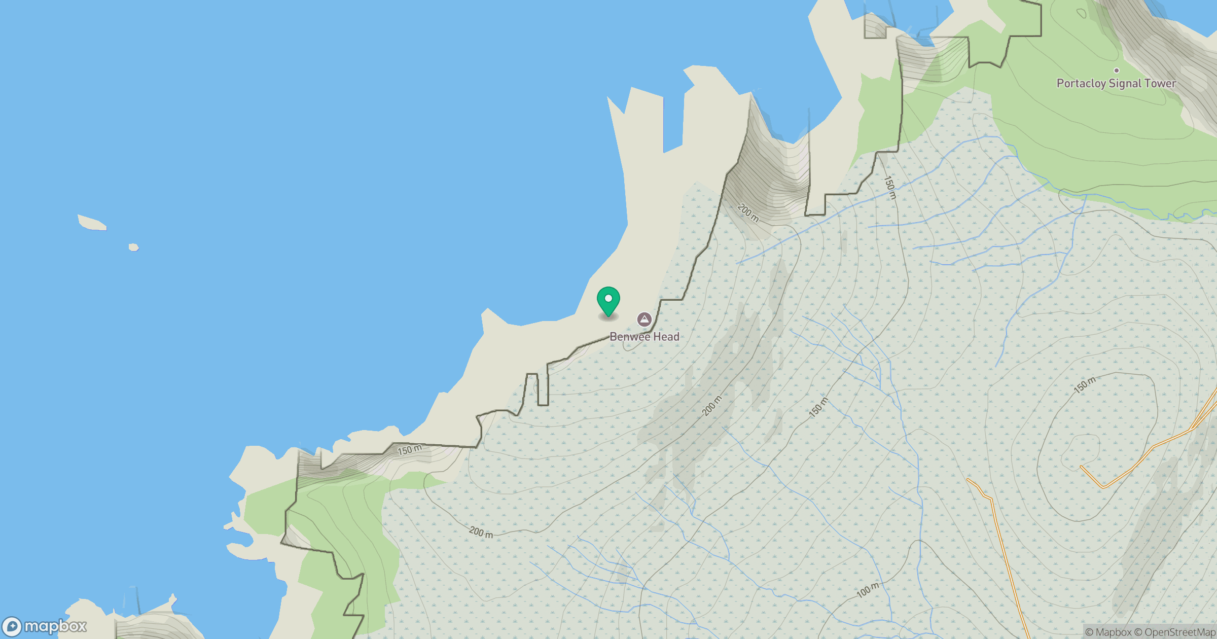
Grid reference: F815443
View on OpenStreetMapOpens a map in a new tab, centred on the hill.
Hills within 30 km
Straight-line distance, not a walking route or confirmation of access.
Barr an Digin [Barradeegin]
229m
Knocknascollop NW Top [Carrowmore Hill] [Cnoc na Scolb]
244m
Slieve Fyagh [Sliabh Fioch]
335m
Tawnaghmore [An Tamhnach Mhor]
340m
Maumakeogh [Mam an Cheo]
379m
No comments yet. Be the first.